Archives for April 2009

The Colorized Version

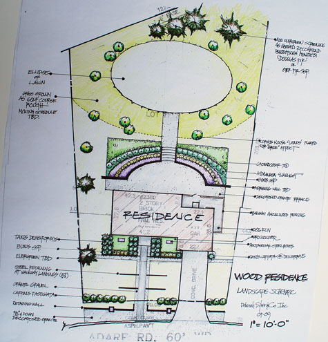
thecolorizedversion3This is stage 3 of the schematic plan.  By schematic, I mean a plan that details only the big gestures and spaces.  It does not tell you which pots to buy, or which cultivar of daylily to plant.  That comes later.  The big decisions get made first.  Where do I want my grill, and my terrace?  Where can my kids play?  Could I host a large party in that spot?  Where do I need shade?  Where can I plant my vegetables?

The colorized version has another purpose besides just being fun to do.  I color every plant that is the same, the same color.  This will tell me instantly if I have too much going on, or not enough. Do I have more landscape than I can take care of? Grass is relatively easy to take care of-if it is a beautiful shape, that grass becomes landscape; the French call it a “tapis vert”.  I can see the shapes of the spaces better in color; are they beautiful, as well as utilitarian, shapes?  Does it look like my house sits in the middle of something bigger that it is? Does my house look like a home now?  Could I imagine that the landscape came first, and the house was set down into it-rather than the other way around?  Can I walk through the landscape, rather than on the edge of it?These are all good questions to ask in advance. You will then be ready for all of nature’s surprises, yet to come.
Geometry

geom1

My high school geometry teacher passed me out of pity. I was suspended for an embarrassing act of pigheadedness at school; he had no choice but to fail me for the midterm I was not in school to take.  His passing me at semester’s end was a gift.   I could not generate a theorem, as I did not understand them.  I had no sense of the beauty of shapes, and how those shapes got generated. Who knew the beauty of geometry would so influence my adult life.  I regret that I failed him-as I do now have a sense of space that I am able to put to paper.

Frankly, I did not have much sense at all at 17. Some of my lack of sense has persisted into my adulthood, and served me well.  Meaning, I have taken on things that anyone with good sense would not. Maybe that’s what my teacher saw in me.

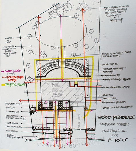
But back to geometry.  Houses have windows, with views framed by those windows.  Any object on dead center in that window frame is “on axis”.  I draw a network of axis lines on my 10 scale plan first. Then I extend lines out from the corners of the house. I draw lines extending from the walks, the driveway, the porch. I draw lines describing traffic flow. I draw lots of lines.  Draw the lines that describe the geometry of your house and property, and how they relate to each other.  View lines are invisible geometry-they make sense once you make the transition from a drawing, to the sculpture that is a landscape. Sometimes landscape frames views. Sometimes it provides a place to be.
[Read more…]

The Big Picture

thebigpicture3

Scale is a big word; there are lots of meanings-many of them designed-charged.   Overscaled can be good, fun, dramatic, compelling- or just plain theatrical.    Underscaled can ruin a beautifully bold idea before the shovel goes in the ground. Proper scale is classic.  This applies to landscapes, fashion, furniture, and rooms; I am sure I am forgetting many others.   When things are the right size, you instinctively know it. Any person could tell you if a portrait of a person is badly drawn-we all know faces, and their proportions, as we have had non-stop exposure to the human face. But most could not draw the human face unless they were taught.  Unless they learned about scale and proportion. The key idea here-some things can be learned, and can be used as a tool to get your design going somewhere.
[Read more…]

Survey Your Spot

surveyyourspot11

surveyyourspot21

To follow is the first in a series of a discussion of how I design. Maybe it will help you; maybe it will inspire your own process.

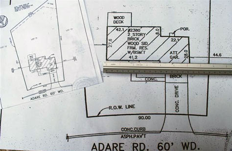
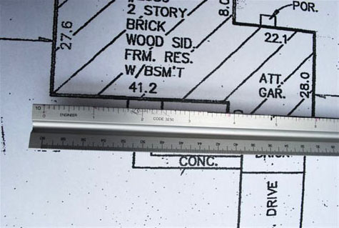
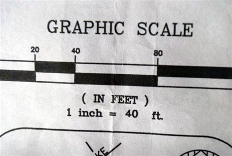
If you are like me, you have a mortgage.  With that, came a mortgage survey; you need to fish that thing out. This document shows how your house, and driveway, and walks sit on the land you own. Mortgage surveys are usually on a single piece of paper-the actual dimensions of your house and land have been scaled to fit that piece of paper.  That scale is on your survey.  Should you read 1″=20′-0″, it means just that. A line on that survey which is 2 inches long, means the space is actually 40 feet long.  Who could draw a landscape bed which is actually 40 feet long in a space that is 2 inches long?  Not me.  So I will take this survey and blow it up times 2-so I have a plan that every inch represents 10 feet.  A survey scaled at 1″=30′, I blow up X 3.  Don’t black out-this is basic math. Take some time to think about it.  Should you not have this time, ask your 8th grader, or your girlfriend who is an engineer to help you. She will no doubt tell you that you need an engineer’s scale.  Enough for today, yes?